
11 Cape Breton Hikes For Your Nova Scotia Itinerary
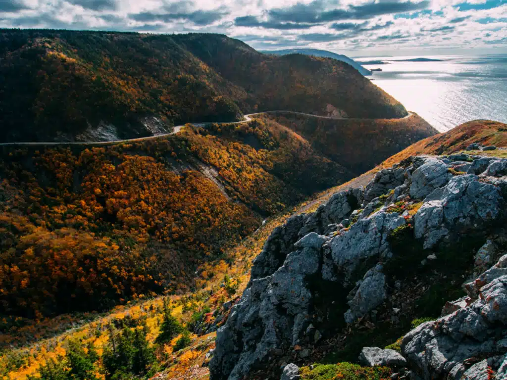
Located in the rugged northeast of Nova Scotia, Cape Breton Island is arguably one of the most beautiful destinations in this unique and stunning province. The famous Cabot Trail is a popular road-tripping destination and is considered one of the world’s most beautiful drives.
Anyone visiting this spectacular island should take advantage of the dozens of hiking trails that wind past some of Cape Breton’s most scenic spots. These unforgettable Cape Breton hikes will give you better views of the area and even more appreciation for the stunning scenery.
In this ultimate guide to the best hikes in Cape Breton, we’re sharing a variety of the most unique and beautiful spots to explore across the island. No matter your fitness ability or desired hiking distance, there are trails for everyone here!
Best Cape Breton Hikes
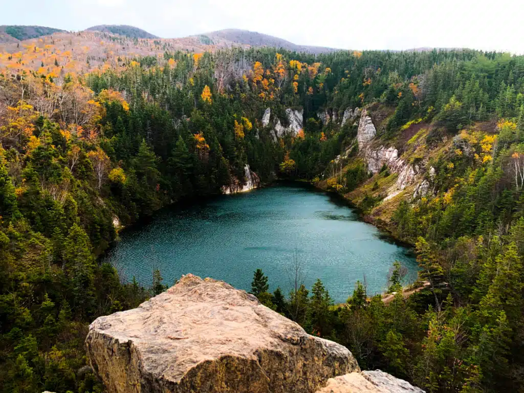
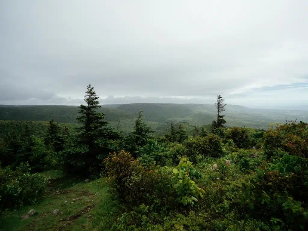
1. Gypsum Mine Trail
Length: 1.6 miles out-and-back
Difficulty Level: Easy
Elevation Gain: 157 feet
The Gypsum Mine Trail is a perfect option, and a local favorite, if you’re looking for an easy hike with a scenic view that packs a punch. One of the best Cape Breton hikes for beginners, this is a must on any Nova Scotia itinerary.
You’ll follow the trail up to the Gypsum Mine Lake and from there you can wander some of the side trails through the white rocks. If you’re brave, you can take the short, steep trail to the upper viewpoint.
There is a rope to help you up the steepest section, and from here you can get a really beautiful view of the lake. On a sunny day, the deep green color really stands out.
Gypsum Mine Trail is located off of Cheticamp Back Road, not far from Cheticamp.
2. Uisge Bàn Falls
Length: 1.7 miles out-and-back
Difficulty Level: Easy
Elevation Gain: 396 feet
Uisge Bàn Falls is one of the best Cape Breton hikes for those who love to walk along rivers and creeks and see amazing wooded scenery and waterfalls.
The trail to the falls starts out with a mostly level and shaded gravel path. As the route progresses, you’ll need to navigate over rocks and roots, so watch your footing and take your time. Near the end of the trail, right before the large waterfall, you even cross a wooden bridge over Falls Brook which makes a great photo op.
You’ll have to do a little rock scrambling at the very end if you want to get up close to Uisge Bàn Falls. Just be careful – when the water is high or after it rains, the rocks will be very slippery, so explore at your own risk.
Uisge Bàn Falls is located off North Branch Road near Baddeck, about 1 hour and 15 minutes west of Sydney.
3. Franey Trail
Length: 4.5-mile loop
Difficulty Level: Difficult
Elevation Gain: 1,118 feet
Franey Trail is one of the longer and more difficult hikes in Cape Breton, but offers rewarding views for the effort. Hikers can either do the trail out-and-back which will cut off a little distance, but if you take the forest road and do the full loop, you’ll see McDougall Lake and more breathtaking scenery.
The route is considered difficult because of the elevation gain. You walk uphill almost the entire way to the lookout, and some sections can be quite steep. However, most people say it’s very doable for intermediate hikers if you take your time and wear good, solid shoes.
Franey Trail is located off Franey Road right outside Ingonish Centre on the eastern side of the Cabot Trail.
4. Meat Cove Overlook
Length: 0.7 miles out-and-back
Difficulty Level: Easy
Elevation Gain: 259 feet
The Meat Cove Overlook Trail is a less popular and rarely visited hike in Meat Cove, but it shouldn’t be discounted. This short and sweet walk offers stunning views of the ocean and the community beach for very little effort.
The trailhead is not well-marked, but it can be found near the Meat Cove Campground. There’s a telephone pole just up the road, and the start of the trail can be found right by it.
You’ll be hiking at a slight incline for most of the hike to the overlook, but it’s not terribly steep or rough. This trail can often be overgrown though, so you may have to walk around some downed trees or uncut brush. Once you get out of the woods though, the path is more clear and you’ll be almost to the top.
Once you reach the overlook, you can either turn around and go back or continue downhill and explore more of the area. This will add additional elevation and distance to the hike, so just keep that in mind.
Meat Cove Overlook is located in Meat Cove, which is the northernmost town in Cape Breton and in Nova Scotia. It’s about a 17-mile detour from the Cabot Trail, but it’s well worth it if you’ve got the time!
Read More: Best Backpacking Destinations on the East Coast of the USA
5. Meat Cove Mountain Trail
Length: 2.3 miles out-and-back
Difficulty Level: Difficult
Elevation Gain: 908 feet
For those who make the drive out to Meat Cove and want a longer and more challenging hike, Meat Cove Mountain Trail is an excellent option. The views at the top are fantastic, and you will get a great overview of Meat Cove and also the surrounding mountains.
Once you reach the top, the trail goes in two separate directions so hikers can experience different viewpoints. This trail is quite steep in places and has some ropes to grab onto at spots. This is not a trail you should attempt in bad weather. Good hiking shoes are an absolute necessity!
Meat Cove Mountain Trail is located along Meat Cove Road just before you get to the community center.
6. Beach Road Trail
Length: 1.9 miles out-and-back
Difficulty Level: Easy
Elevation Gain: 177 feet
Beach Road Trail is an easy, 1.9-mile trail that takes hikers along Ingonish Beach. This is a great walk for families and for people who want to spend some time meandering along the water. This would also be a nice place to pack a cooler and have a picnic lunch.
Beach Road Trail is located right on Ingonish Beach off of the Cabot Trail on the east side.
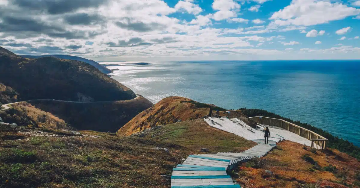
7. Skyline Trail Loop
Length: 6.3-mile loop
Difficulty Level: Moderate
Elevation Gain: 908 feet
The Skyline Trail Loop is probably the most famous and photographed trail on Cape Breton. The stunning views along the coast are some of the best in the area, and the picturesque staircase at the end is all over Instagram.
That being said, the hike through the woods to the coast is not particularly special. You’ll be traveling along a well-maintained and level gravel trail, but there isn’t much to look at along the way. However, the highlight of the wooded section is the potential to see moose, so keep your eyes open!
Almost all of the elevation on this trail is at the end when you reach the staircase. For those who don’t want to do the stairs (or not all of them), you’ll still have a gorgeous view. There are plenty of benches and resting places for those who want to brave all the steps.
Since this trail is so popular, it is almost always crowded. It is one of the best places to see the sunset and the number of people on the trail around dusk will reflect that, but if you want to avoid the masses, consider going in the morning.
Skyline Trail Loop is located right off the Cabot Trail a few miles north of Cheticamp on the western side of the island.
8. Jack Pine Loop
Length: 1.3-mile loop
Difficulty Level: Easy
Elevation Gain: 147 feet
If you’re looking for a short, easy hike with beautiful ocean views and lots of gorgeous trees, the Jack Pine Loop is the Cape Breton hike for you.
With very little elevation gain and a well-marked trail, this short loop will surprise you with how much scenery can change in such a short distance. You’ll go from a thick, wooded path to open, sweeping ocean views. There are also a lot of rocks and roots, so wear appropriate footwear and watch your step.
Jack Pine Loop is located just south of Neils Harbor along the eastern side of the Cabot Trail.
9. Broad Cove Mountain
Length: 1.4 miles out-and-back
Difficulty Level: Moderate
Elevation Gain: 488 feet
Broad Cove Mountain is another popular hike along the Cabot Trail that offers wonderful views without having to hike very far. The steeper sections of this hike have stairs, which makes the incline a bit easier.
Once you reach the top, you’ll be rewarded with views of Middle Head, Cape Smokey, Ingonish, and Broad Cove.
Broad Cove Mountain is located off the Cabot Trail not far from the Broad Cove Campground. Final Thoughts: Hikes in Cape Breton, Nova Scotia
10. Middle Head Trail
Length: 2.8-mile loop
Difficulty Level: Moderate
Elevation Gain: 531 feet
Middle Head Trail offers beautiful ocean views for most of the hike as well as plenty of opportunities to spot birds. In the spring and summer, hikers can also see wildflowers and blueberries.
The trail is fairly level with some rocky sections. It is also well-marked. Hikers can choose to take the loop in either direction, but many people say hiking it counterclockwise is best.
At the very tip of the peninsula is one of the famous Canadian National Park’s red Adirondack chairs. These are scattered throughout Cape Breton National Park as well as the other national parks in Canada.
Middle Head Trail is located off Keltic Road near Ingonish Centre along the Cabot Trail.
11. White Point Lookout
Length: 1.5 miles out-and-back
Difficulty Level: Easy
Elevation Gain: 154 feet
White Point Lookout is worth the slight detour off of the Cabot Trail. The scenery here felt like a hike through the Highlands of Scotland! Visitors will be treated to amazing views of the ocean and the rocky cliffs.
While the hike itself should only take you about 30 minutes to complete, the area itself is worth taking some extra time and exploring. See what kinds of birds you can spot along the cliffs and wander around the various paths.
There’s even a cemetery and a cross that you can visit. Just make sure you are respectful!
White Point Lookout is located off White Point Road near White Point. The parking lot is pretty small, so if it’s full, be prepared to park a little further away and walk if necessary.
Hiking in Cape Breton
No matter your fitness level or desired hiking distance, Cape Breton has a hike for you! Whether you’re looking for waterfalls, sweeping ocean views, or mountain vistas, you’ll be sure to find it on your next visit to Nova Scotia!

Carley Rojas Avila is a bilingual New York-based travel writer, editor, content marketer, and the founder of the digital travel publications Explorers Away and Home to Havana. Carley is an expert on all things Latin America, the Caribbean, and Cuba, having lived and worked in four different countries in the region. Her writing has appeared on the Associated Press wires and in Travel + Leisure, Yahoo, MSN, Euronews, The Weather Channel, and more. When she's not writing about her travels, find her front row at a Bad Bunny concert, befriending street cats, and taste-testing every pizza in Havana.